The KÉZDI_Adapt project has completed an agricultural drought hazard and risk assessment for Târgu Secuiesc and Covasna County, examining the impacts of climate change on potato, maize, wheat and rapeseed production at the micro-regional level.
The analysis compared projected drought impacts between the near-future period (2026–2030) and the mid-century period (2046–2050), focusing on crop yield reductions and associated revenue losses. Using downscaled climate variables, the assessment provided a detailed understanding of local drought hazards and risks, supporting the development of more effective regional and local adaptation strategies.
Results from Phase 2 highlighted the importance of methodology, spatial scale and climate model selection in determining drought impact estimates. The study found that regional-scale analyses can amplify projected losses through averaging effects, while local assessments provide more nuanced and realistic results that better reflect local conditions.
Below: Yield loss maps using GIS data
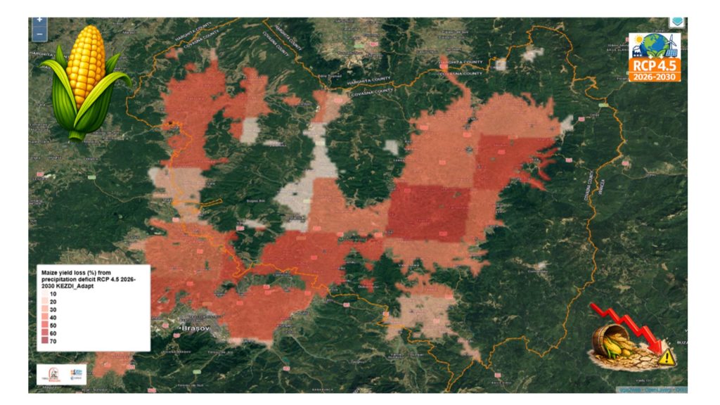
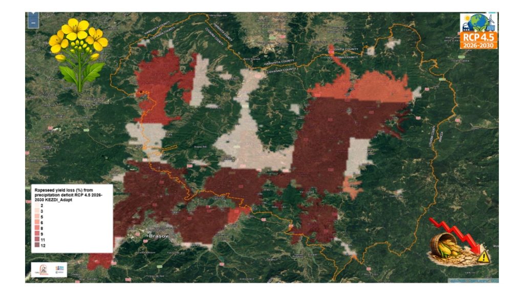
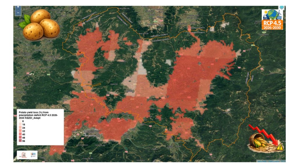
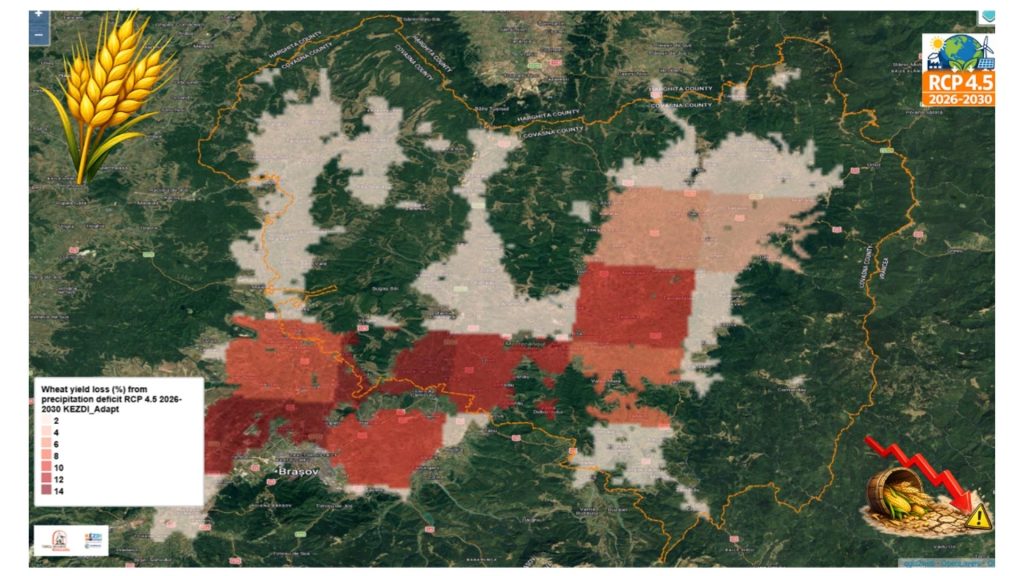
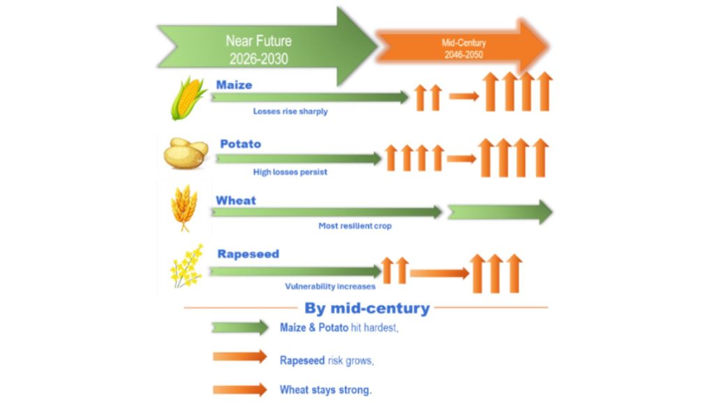
The assessment also confirmed consistent crop vulnerability patterns across different scales. Maize emerged as the most drought-sensitive crop, followed by potato, while wheat and rapeseed showed lower levels of vulnerability. The integration of local crop calendars, seasonal information and high-resolution datasets improved the accuracy of risk estimates and helped identify crop-specific vulnerabilities that may not be visible in broader regional analyses.
A key finding of the study is the growing challenge posed by water stress. Persistent negative climatic water balance across future scenarios indicates increasing pressure on water resources, highlighting the need for improved irrigation systems and more effective water management strategies.
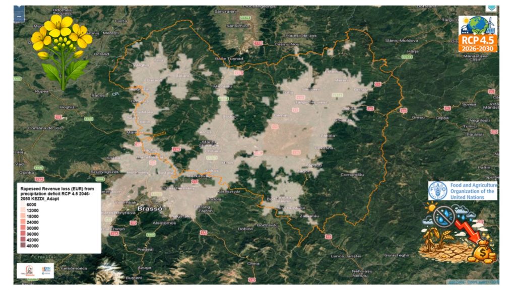
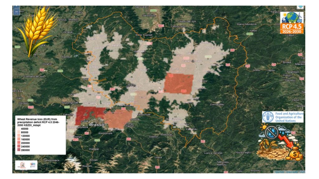
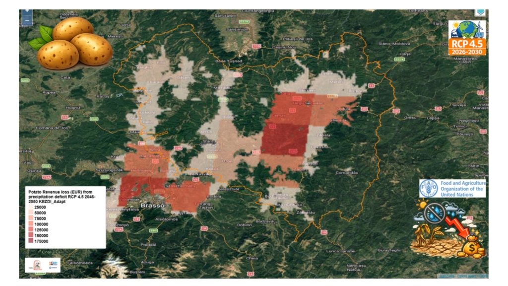
below: Revenue loss maps using GIS data
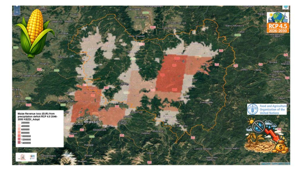
Economic assessments reflected these trends, with maize accounting for the largest share of projected losses. Under the RCP 4.5 scenario, near-future economic losses for maize are projected to exceed €1.38 million, although some crops show reduced impacts by mid-century, potentially reflecting adaptation effects or changing climatic conditions.
Overall, the results demonstrate that localized and carefully calibrated risk assessments are essential for understanding agricultural drought impacts and supporting evidence-based adaptation planning. The findings provide valuable guidance for crop selection, irrigation planning and climate resilience measures aimed at strengthening the long-term sustainability of agriculture in the region.
Key Lessons Learned
- Methodology is decisive: Workflow design, spatial scale, model choice, and local data integration strongly control the magnitude and credibility of drought impact results. Large regional analyses often overestimate losses, while fine-tuned local approaches deliver more realistic and actionable insights.
- Crop vulnerability is highly differentiated: Maize consistently shows the highest drought sensitivity, followed by potato, while wheat is the least affected. This pattern holds across scales but requires local calibration for accurate risk profiling.
- Water stress is structural and growing: Persistent negative climatic water balance drives significant biophysical and economic risks (especially for maize), underscoring the urgent need for improved water management, irrigation, and targeted adaptation strategies at local levels.