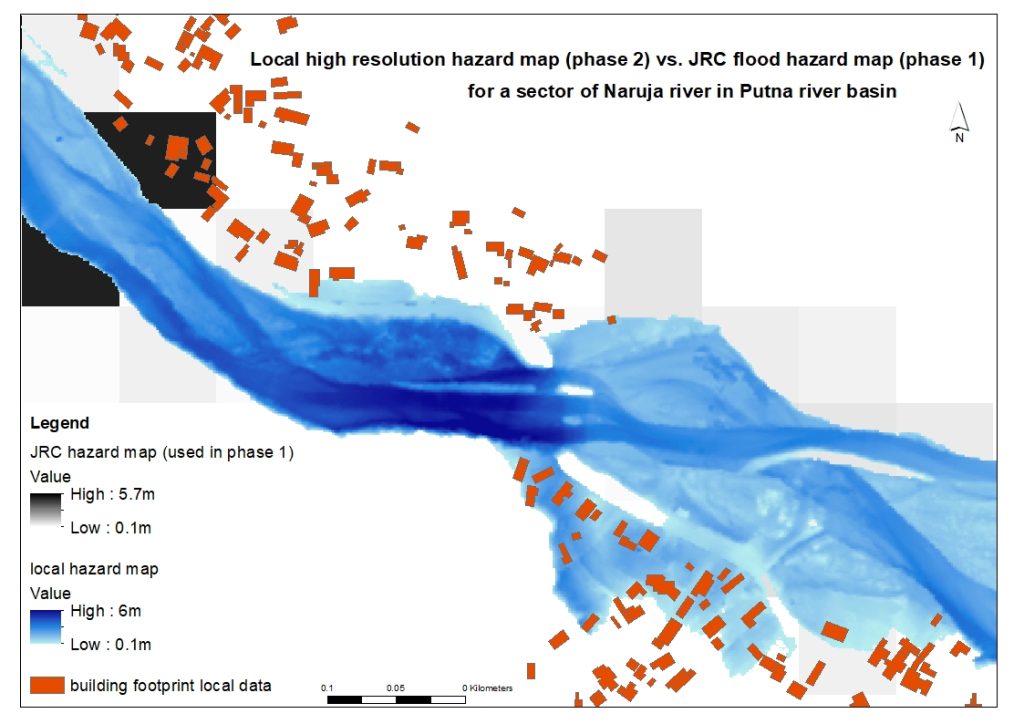
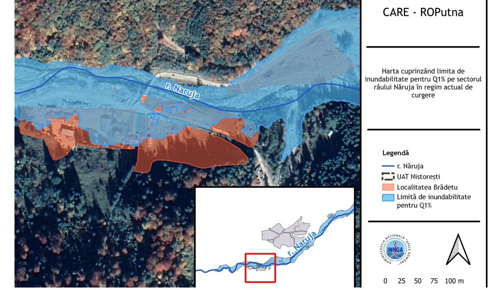
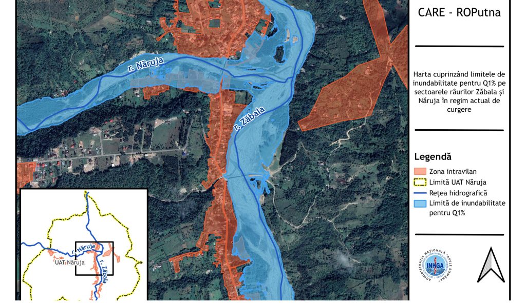
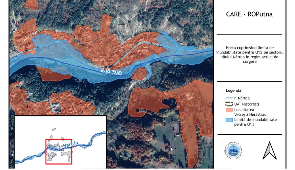
As part of the CLIMAAX CARE-ROPutna project, the second phase of work has focused on building a detailed Climate Risk Assessment (CRA) for the Putna River Basin through the integration of high-resolution local data. The team collected, analyzed, and processed multiple datasets to develop localized flood hazard maps based on 1-meter Digital Terrain Models (DTM) and discharge values corresponding to different exceedance probabilities. These new maps—significantly more detailed than the JRC models used in phase one—offer a robust foundation for the upcoming flood risk analysis.
In parallel, a first stakeholder workshop titled “The CARE-ROPutna Project – Introductory Workshop” was held on 23 September at the Vrancea Water Management Unit headquarters in Focșani. More than 20 representatives from key institutions participated, including the Vrancea County Council, Prefecture, local municipalities, the Siret River Basin Administration, and the Vrancea County Environmental Agency.
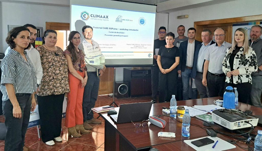
The event marked an important step toward co-developing locally adapted climate risk assessments. Participants engaged in presentations, discussions, and a survey designed to gather insights on local priorities, knowledge gaps, and interest in future collaboration.
By combining technical precision with local participation, the CARE-ROPutna project is paving the way for a data-driven and community-informed approach to flood resilience in Romania.